AI-Powered Scan-to-BIM for Architects
Get precise as-built 3D BIM/2D Planned models with Observance. Reduce site visits, cut rework costs, and streamline workflows using AI-driven Platform.
Comprehensive Scan-to-BIM Solutions
Measurable As-Built 3D and 2D
Deliver precise 3D models within a day, enabling length, area, angle, and volume measurements with unmatched accuracy.
Exportable to DWG, RVT & GLTF
Export 3D BIMs, 3D scans, and 2D as-built drawings to AutoCAD, Revit, SketchUp, and other supported formats.
Scan-To-BIM
Generate detailed LOD350 BIMs from AI-segmented 3D models, offering architects accurate and comprehensive project data.
Reduce Site Visits
Access precise 3D models and 2D drawings remotely, reducing site visits with 99.6% measurement accuracy.
Reduce Rework Costs
Prevent errors and minimize rework with precise integration of MEP elements, sockets, and slab heights.
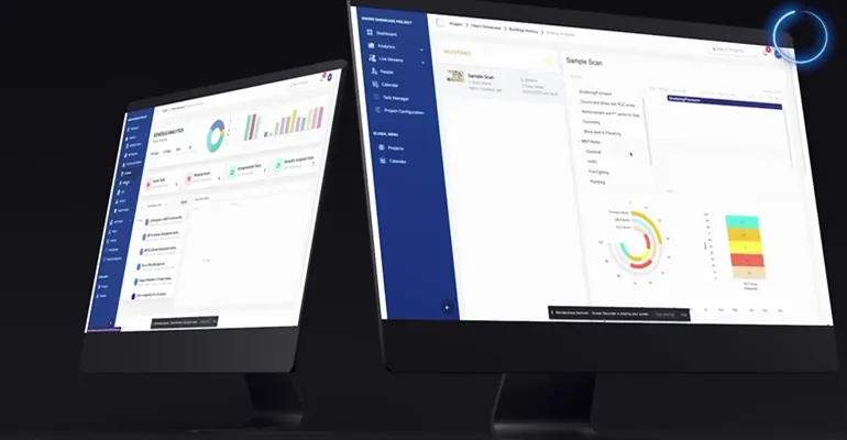
Observance Eye Integration
Leverage 360° site capture and progress monitoring with real-time walkthroughs and annotation capabilities for comprehensive project oversight.
The Measurable 3D Model!
3D Mesh
Freely navigable, downloadable, and measurable as-built 3D model available on Observance.
2D Plan
Vectorized, scaled as-built floorplan with DXF (AutoCAD) export option.
Measurements
Supports accurate linear, angular, area, and volume measurements in imperial or metric units.
Accuracy
Observance outputs achieve 99.6% measurement accuracy.
Real-time Construction Progress Monitoring
360° Site Walkthroughs
Take virtual tours of your construction site with real-time 360° walkthroughs for complete transparency.
Side-by-Side Comparisons
Compare past vs current site conditions with precision to monitor progress and identify changes over time.
Remote Monitoring
Monitor your projects from anywhere with mobile and desktop access for multi-project management.
Annotation & Task Management
Spot, tag, and solve issues instantly with precise localization and seamless task assignment capabilities.